ZCZC MIATWOEP ALL
TTAA00 KNHC DDHHMM

Tropical Weather Outlook
NWS National Hurricane Center Miami FL
500 PM PDT Sat Jun 17 2023

For the eastern North Pacific...east of 140 degrees west longitude:

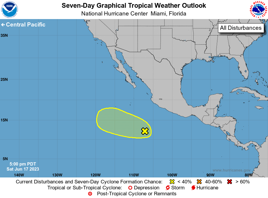
1. Central East Pacific (EP90):
A tropical wave continues to produce disorganized showers and
thunderstorms several hundred miles south-southwest of southwestern
Mexico.  Some slow development is possible during the next couple of
days while the system moves west-northwestward at about 10 mph.
However, its chances of formation appear to end by Tuesday when the
system is expected to move into unfavorable environmental
conditions.
* Formation chance through 48 hours...low...20 percent.
* Formation chance through 7 days...low...20 percent.

Forecaster Cangialosi





 NHC on Facebook
 Twitter
 YouTube
 NHC Blog: