ZCZC MIATWOEP ALL
TTAA00 KNHC DDHHMM

Tropical Weather Outlook
NWS National Hurricane Center Miami FL
1100 AM PDT Sun Sep 17 2023

For the eastern North Pacific...east of 140 degrees west longitude:

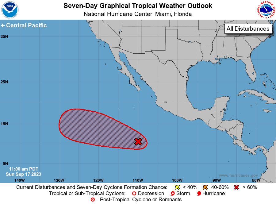
1. Central East Pacific:
Showers and thunderstorms associated with a broad area of low
pressure located well south of the southern tip of the Baja
California peninsula continue to show signs of becoming better
organized. This system is currently elongated, but environmental
conditions are expected to allow for additional development during
the next few days. A tropical depression is expected to form by the
middle of the week while the system moves west-northwestward over
the central and western portions of the basin.
* Formation chance through 48 hours...medium...40 percent.
* Formation chance through 7 days...high...80 percent.

Forecaster D. Zelinsky





 NHC on Facebook
 Twitter
 YouTube
 NHC Blog: