ZCZC MIATWOEP ALL
TTAA00 KNHC DDHHMM

Tropical Weather Outlook
NWS National Hurricane Center Miami FL
500 PM PDT Sun Jul 2 2023

For the eastern North Pacific...east of 140 degrees west longitude:

Active Systems:
The National Hurricane Center has issued the last advisory on
Post-Tropical Cyclone Adrian, located several hundred miles
west-southwest of the southern tip of the Baja California peninsula.

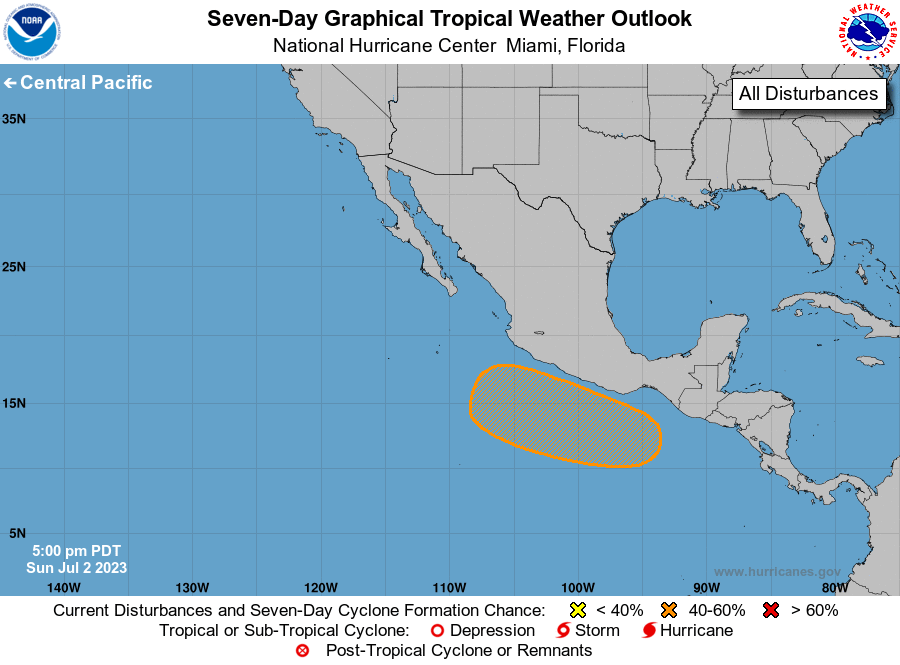
1. Offshore of Southern Mexico:
A broad area of low pressure will likely form several hundred miles
off the coast of southern Mexico in a few days. Thereafter,
environmental conditions are forecast to be conducive for gradual
development of this system and a tropical depression could form late
in the week or over the weekend while it moves generally
west-northwestward, roughly parallel to the southern and
southwestern coasts of Mexico.
* Formation chance through 48 hours...low...near 0 percent.
* Formation chance through 7 days...medium...50 percent.

Forecaster Cangialosi





 NHC on Facebook
 Twitter
 YouTube
 NHC Blog: