ZCZC MIATWOAT ALL
TTAA00 KNHC DDHHMM
Tropical Weather Outlook
NWS National Hurricane Center Miami FL
200 PM EDT Mon Oct 30 2023
For the North Atlantic...Caribbean Sea and the Gulf of Mexico:
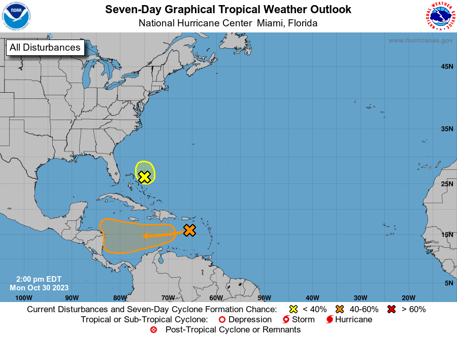
1. Southwestern Atlantic Ocean (AL96):
An area of low pressure with associated disorganized showers is
located about 100 miles east of the northwestern Bahamas. This
system is moving into an area of strong upper-level winds and dry
air, and the chances of it becoming a short-lived tropical storm are
decreasing. The low is expected to move slowly northwestward today
and then turn northward and northeastward on Tuesday and Wednesday.
Additional information on this system, including gale warnings, can
be found in High Seas Forecasts issued by the National Weather
Service.
* Formation chance through 48 hours...low...10 percent.
* Formation chance through 7 days...low...10 percent.
2. Southwestern Caribbean Sea:
A trough of low pressure over the eastern Caribbean Sea is producing
disorganized showers and thunderstorms. This system is expected to
move westward during the next several days, and environmental
conditions appear conducive for gradual development. A tropical
depression could form late this week when the system reaches the
central or southwestern Caribbean Sea.
* Formation chance through 48 hours...low...20 percent.
* Formation chance through 7 days...medium...60 percent.
High Seas Forecasts issued by the National Weather Service
can be found under AWIPS header NFDHSFAT1, WMO header FZNT01
KWBC, and online at ocean.weather.gov/shtml/NFDHSFAT1.php
Forecaster Blake