ZCZC MIATWOAT ALL
TTAA00 KNHC DDHHMM
Tropical Weather Outlook
NWS National Hurricane Center Miami FL
800 PM EDT Sun Oct 29 2023
For the North Atlantic...Caribbean Sea and the Gulf of Mexico:
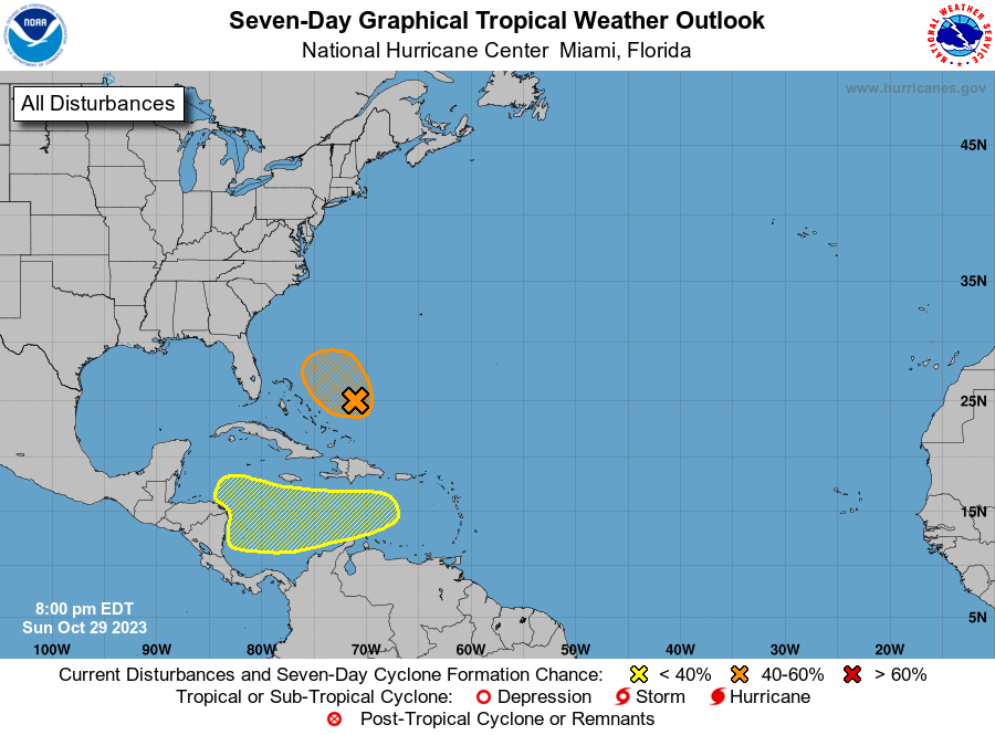
1. Southwestern Atlantic Ocean (AL96):
Earlier today, an Air Force Reserve reconnaissance aircraft
investigated a broad area of low pressure located a couple of
hundred miles east of the central Bahamas, finding that the system
did not possess a well-defined surface circulation, but was
producing winds around 40 mph on its northeastern side. Shower and
thunderstorm activity persists, but the system only has limited time
to develop into a short-lived tropical depression or storm over the
next day or so as it moves slowly west-northwestward. By Tuesday,
strong upper-level winds and dry air should end the chances for
further development as the system turns northward away from the
northwestern Bahamas. Additional information on this system,
including gale warnings, can be found in High Seas Forecasts issued
by the National Weather Service.
* Formation chance through 48 hours...medium...40 percent.
* Formation chance through 7 days...medium...40 percent.
2. Southwestern Caribbean Sea:
A broad area of low pressure could form in a few days over the
central or southwestern Caribbean Sea. Environmental conditions
appear conducive for some gradual development thereafter while the
system moves generally westward at 10 to 15 mph towards Central
America.
* Formation chance through 48 hours...low...near 0 percent.
* Formation chance through 7 days...low...30 percent.
High Seas Forecasts issued by the National Weather Service
can be found under AWIPS header NFDHSFAT1, WMO header FZNT01
KWBC, and online at ocean.weather.gov/shtml/NFDHSFAT1.php
Forecaster Papin