ZCZC MIATWOAT ALL
TTAA00 KNHC DDHHMM
Tropical Weather Outlook
NWS National Hurricane Center Miami FL
800 PM EDT Thu Oct 26 2023
For the North Atlantic...Caribbean Sea and the Gulf of Mexico:
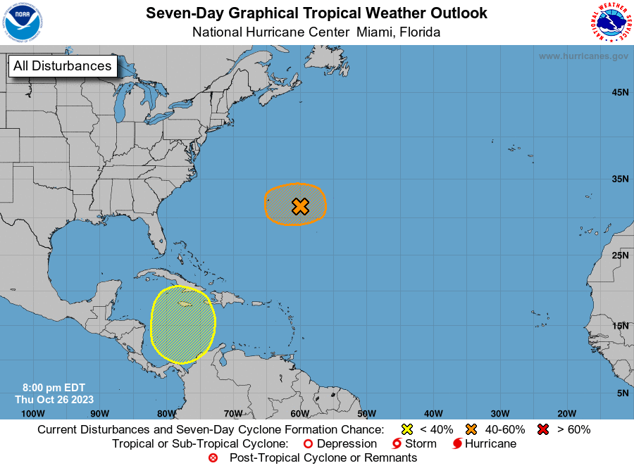
1. Northwestern Atlantic (Post-Tropical Cyclone Tammy):
A strong extratropical cyclone (formerly Tammy) associated with an
occluded front is located a few hundred miles east of Bermuda. This
system is forecast to become separated from the front during the
next day or so, and environmental conditions are forecast to become
more conducive for the low to regain tropical characteristics while
it meanders over the northwestern Atlantic to the east of Bermuda
through Saturday. Regardless of tropical redevelopment, the system
is likely to bring gusty winds and heavy rainfall to Bermuda during
the next couple of days. Interests on Bermuda should monitor the
progress of this system. For additional information, including storm
and gale warnings, see High Seas Forecasts issued by the National
Weather Service and products from the Bermuda Weather Service.
* Formation chance through 48 hours...medium...50 percent.
* Formation chance through 7 days...medium...50 percent.
2. Western Caribbean Sea:
A broad area of low pressure is forecast to develop over the
southwestern Caribbean Sea during the next few days. Environmental
conditions could support some slow development of this system early
next week while it moves generally northward over western or central
portions of the basin.
* Formation chance through 48 hours...low...near 0 percent.
* Formation chance through 7 days...low...20 percent.
High Seas Forecasts issued by the National Weather Service
can be found under AWIPS header NFDHSFAT1, WMO header FZNT01
KWBC, and online at ocean.weather.gov/shtml/NFDHSFAT1.php
Forecaster Reinhart