ZCZC MIATWOAT ALL
TTAA00 KNHC DDHHMM
Tropical Weather Outlook
NWS National Hurricane Center Miami FL
200 AM EDT Thu Jul 13 2023
For the North Atlantic...Caribbean Sea and the Gulf of Mexico:
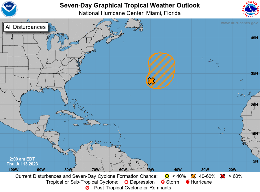
1. Central Atlantic (AL94):
An area of low pressure located more than 800 miles east of Bermuda
continues to produce disorganized showers and thunderstorms
primarily to the east and southeast of its center. Environmental
conditions are forecast to be marginally conducive for this system
to become a subtropical depression or storm during the next couple
of days while it meanders over the central Atlantic. By the weekend,
the low should turn northward bringing the system over cooler
waters, potentially limiting additional development. Additional
information on this system, including gale warnings, can be found in
High Seas Forecasts, issued by the National Weather Service.
* Formation chance through 48 hours...medium...60 percent.
* Formation chance through 7 days...medium...60 percent.
High Seas Forecasts issued by the National Weather Service
can be found under AWIPS header NFDHSFAT1, WMO header FZNT01
KWBC, and online at ocean.weather.gov/shtml/NFDHSFAT1.php
Forecaster Brown