ZCZC MIATWOAT ALL
TTAA00 KNHC DDHHMM
Tropical Weather Outlook
NWS National Hurricane Center Miami FL
200 AM EDT Mon Jun 19 2023
For the North Atlantic...Caribbean Sea and the Gulf of Mexico:
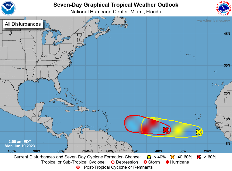
1. Central Tropical Atlantic (AL92):
Showers and thunderstorms continue to become better organized in
association with a broad area of low pressure located several
hundred miles west-southwest of the Cabo Verde Islands.
Environmental conditions appear conducive for additional
development, and a tropical depression or tropical storm is expected
to form later today or tonight. This system is forecast to move
generally westward at 15 to 20 mph across the central tropical
Atlantic through the middle part of this week. Additional
information on this system, including gale warnings, can be found in
High Seas Forecasts issued by the National Weather Service.
* Formation chance through 48 hours...high...90 percent.
* Formation chance through 7 days...high...90 percent.
2. Eastern Tropical Atlantic:
An area of disorganized showers and thunderstorms located several
hundred miles south of the Cabo Verde Islands is associated with a
tropical wave. Some gradual development of this system is possible
through the middle and latter parts of this week as it moves
westward at 10 to 15 mph across the eastern and central tropical
Atlantic.
* Formation chance through 48 hours...low...20 percent.
* Formation chance through 7 days...low...30 percent.
High Seas Forecasts issued by the National Weather Service
can be found under AWIPS header NFDHSFAT1, WMO header FZNT01
KWBC, and online at ocean.weather.gov/shtml/NFDHSFAT1.php
Forecaster Reinhart