


NHC Graphical Outlook Archive
« Earliest Available ‹ Earlier Later › Latest Available »
Place your mouse cursor over areas of interest for more information
| GIS data: .shp |
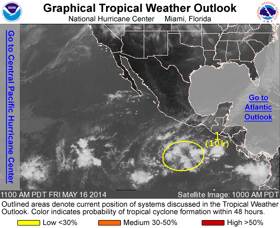
ZCZC MIATWOEP ALL
TTAA00 KNHC DDHHMM

TROPICAL WEATHER OUTLOOK
NWS NATIONAL HURRICANE CENTER MIAMI FL
1100 AM PDT FRI MAY 16 2014

For the eastern North Pacific...east of 140 degrees west longitude:

Systems with the potential to become a tropical cylcone during the
next 48 hours...

1. An area of disturbed weather located several hundred miles south
of Acapulco, Mexico, is producing disorganized showers and a few
thunderstorms.  Environmental conditions could become a little
more conducive for development during the next few days while the
system moves slowly westward to west-northwestward.
* Formation chance through 48 hours...low...10 percent
* Formation chance through 5 days...low...20 percent

Forecaster Brown
List of all Atlantic Outlooks
List of all East Pacific Outlooks