ZCZC MIATWOEP ALL
TTAA00 KNHC DDHHMM
Tropical Weather Outlook
NWS National Hurricane Center Miami FL
500 PM PDT Thu Aug 10 2017
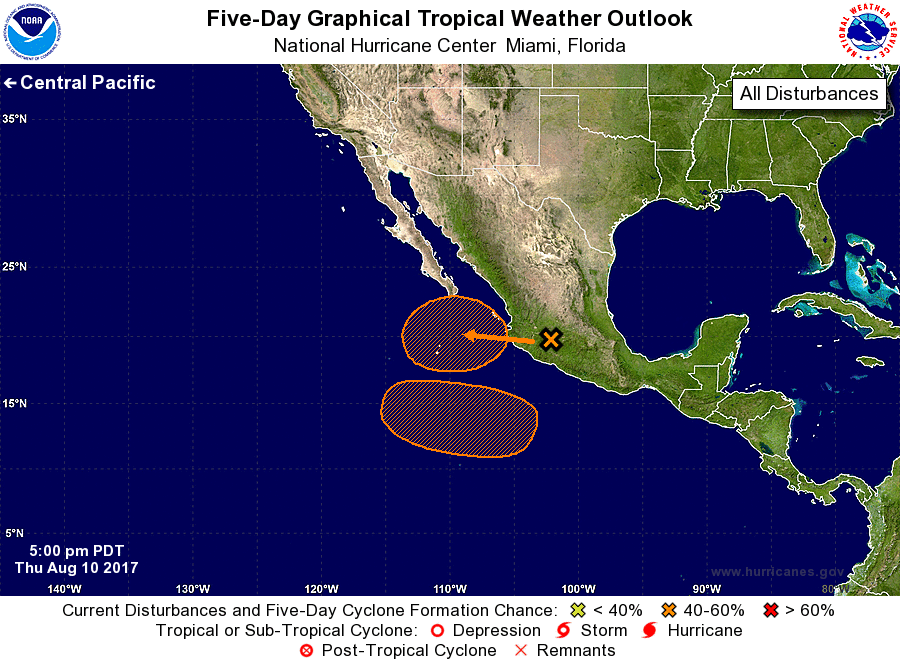
For the eastern North Pacific...east of 140 degrees west longitude:
1. An area of low pressure is expected to form just off the
west-central coast of Mexico on Friday in association with the
remnants of Franklin. Environmental conditions appear conducive for
some development, and this low could become a tropical cyclone
during the next couple of days before it moves over colder waters on
Sunday.
* Formation chance through 48 hours...medium...50 percent.
* Formation chance through 5 days...medium...50 percent.
2. Another area of low pressure is forecast to form well south of the
coast of southern Mexico by early next week. Environmental
conditions are expected to be conducive for some slow development of
this system as it moves west-northwestward at 10 to 15 mph.
* Formation chance through 48 hours...low...near 0 percent.
* Formation chance through 5 days...medium...40 percent.
Forecaster Blake