


NHC Graphical Outlook Archive
|
« Earliest Available ‹ Earlier Later › Latest Available » |
GIS Shapefiles |
| Eastern Pacific | Atlantic |
|
Tropical Weather Outlook Text
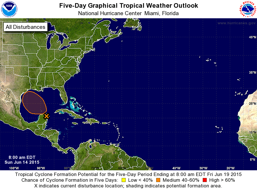
ZCZC MIATWOAT ALL
TTAA00 KNHC DDHHMM

TROPICAL WEATHER OUTLOOK
NWS NATIONAL HURRICANE CENTER MIAMI FL
800 AM EDT SUN JUN 14 2015

For the North Atlantic...Caribbean Sea and the Gulf of Mexico:

1. A sharp trough of surface low pressure across the Yucatan Peninsula,
in combination with an upper-level low over the Gulf of Mexico,
continues to produce showers and thunderstorms over portions of
Guatemala, Belize, the Yucatan, and adjacent waters.  Upper-level
winds are expected to become more favorable for some development
over the next day or two as the system moves northwestward into the
western Gulf of Mexico, and an Air Force Reserve Hurricane Hunter
aircraft is scheduled to investigate the system this afternoon.
Heavy rains are expected to continue over these areas today, along
with winds to near gale force over portions of the northwestern
Caribbean Sea and the southeastern Gulf of Mexico. Additional
information on this system can be found in High Seas Forecasts
issued by the National Weather Service.
* Formation chance through 48 hours...medium...60 percent
* Formation chance through 5 days...medium...60 percent

High Seas Forecasts can be found under AWIPS header NFDHSFAT1 and
WMO header FZNT01 KWBC.

Forecaster Franklin
List of Atlantic Outlooks (May 2023 - present)
List of East Pacific Outlooks (May 2023 - present)
List of Central Pacific Outlooks (May 2023 - present)
List of Atlantic Outlooks (July 2014 - April 2023)
List of East Pacific Outlooks (July 2014 - April 2023)
List of Central Pacific Outlooks (June 2019 - April 2023)
List of Atlantic Outlooks (June 2009 - June 2014)
List of East Pacific Outlooks (June 2009 - June 2014)