ZCZC MIATWOAT ALL
TTAA00 KNHC DDHHMM
Tropical Weather Outlook
NWS National Hurricane Center Miami FL
200 PM EDT Fri Oct 26 2018
For the North Atlantic...Caribbean Sea and the Gulf of Mexico:
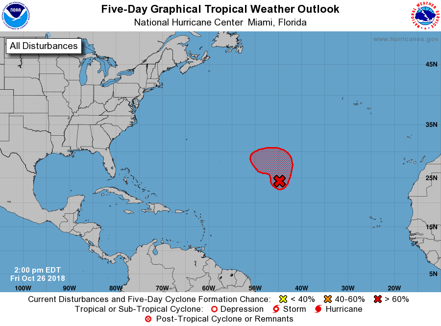
1. Recent satellite data indicate that a broad area of low pressure
located about 1200 miles east-northeast of the northern Leeward
Islands does not yet have a well-defined center. However, the
system is producing tropical-storm-force winds to the east of the
broad low and a tropical or subtropical storm is likely to form
tonight or tomorrow. The system is expected to move northward to
north-northeastward over the central Atlantic through tonight, and
then turn westward on Saturday, remaining well to the north or
northeast of the Lesser Antilles through early next week.
* Formation chance through 48 hours...high...90 percent.
* Formation chance through 5 days...high...90 percent.
Additional information on this system can be found in High Seas
Forecasts issued by the National Weather Service, under AWIPS
header NFDHSFAT1, WMO header FZNT01 KWBC, and available on the Web
at https://ocean.weather.gov/shtml/NFDHSFAT1.shtml
Forecaster Zelinsky