ZCZC HFOTWOCP ALL
TTAA00 PHFO DDHHMM
Tropical Weather Outlook
NWS Central Pacific Hurricane Center Honolulu HI
200 PM HST Tue Oct 29 2024
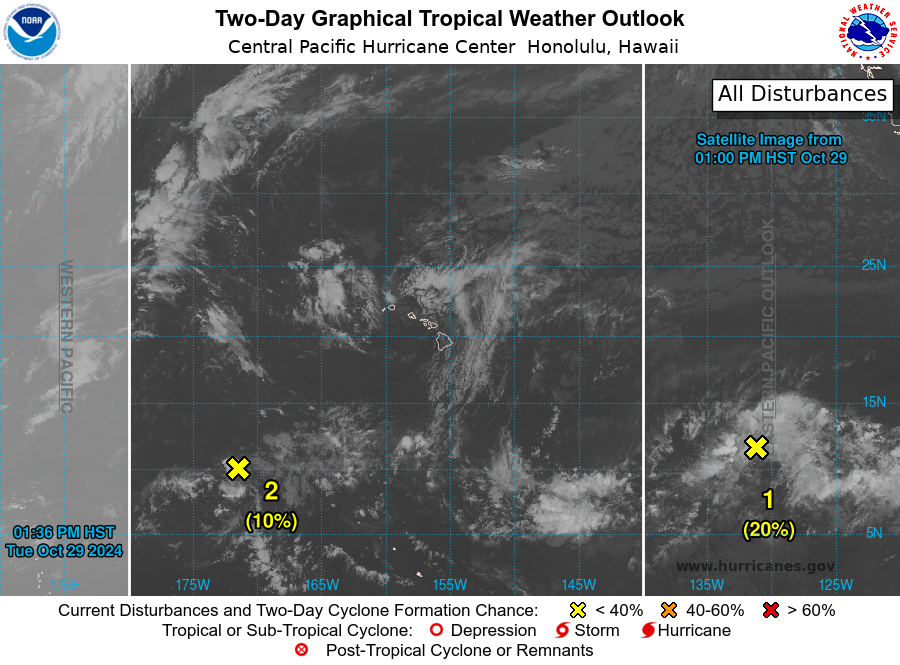
For the central North Pacific...between 140W and 180W:
1. About 1700 miles east-southeast of Hilo, Hawaii (EP91):
A broad area of low pressure is producing disorganized shower
activity. While this system isn\'t any better organized since
yesterday, a tropical depression could still form within a few days
while the system moves generally westward at about 15 mph. This
system is expected to cross into the Central Pacific Basin by
the end of the week.
* Formation chance through 48 hours...low...20 percent.
* Formation chance through 7 days...low...30 percent.
2. About 1300 miles west-southwest of Hilo, Hawaii:
A broad area of low pressure is producing disorganized shower
activity far west-southwest of the Hawaiian Islands. The
environment appears to be favorable for some slow development over
the next couple of days as the system moves generally westward at
about 15 mph. The system is expected to cross into the Western
Pacific Basin in the next 48 hours.
* Formation chance through 48 hours...low...10 percent.
* Formation chance through 7 days...low...10 percent.
Elsewhere, no tropical cyclones are expected during the next 7
days.
Forecaster Almanza