ZCZC HFOTWOCP ALL
TTAA00 PHFO DDHHMM
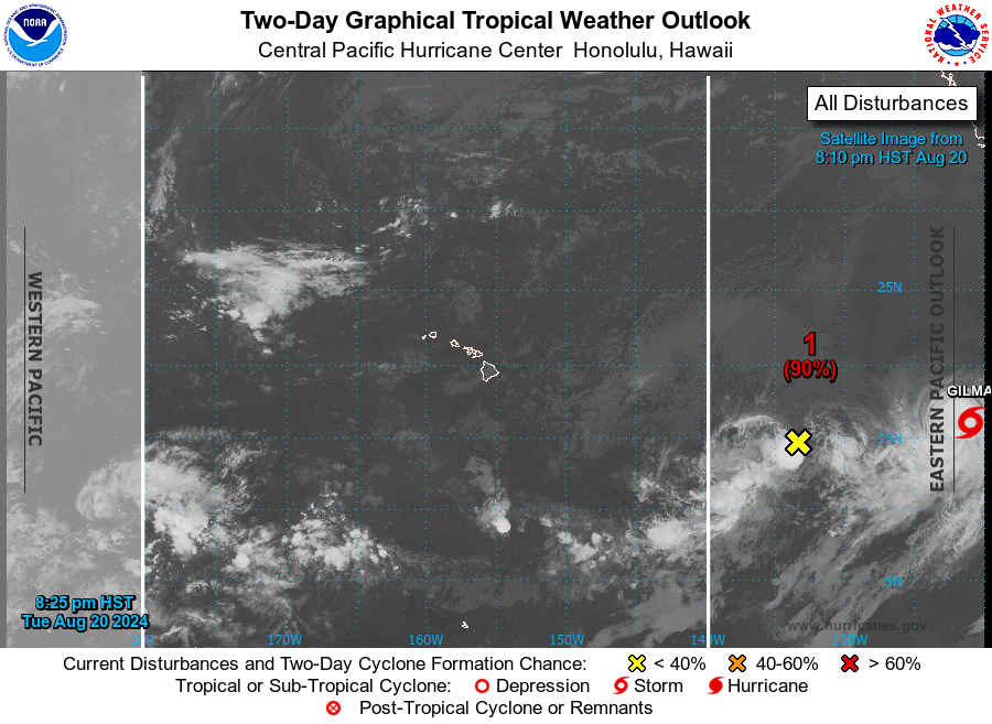
Tropical Weather Outlook
NWS Central Pacific Hurricane Center Honolulu HI
800 PM HST Tue Aug 20 2024
For the central North Pacific...between 140W and 180W:
Approximately 1350 miles east-southeast of the Hawaiian Islands
(EP90/EP91):
Showers and thunderstorms associated with a well-defined area of
low pressure located well east southeast of the Hawaiian Islands
are gradually becoming better organized, and only a slight increase
in organization could result in the formation of a tropical
depression or tropical storm while it moves generally westward at
10 to 15 mph. The weaker disturbance located just to its southwest
is expected to dissipate or merge with this system during the next
several hours. This system is expected to strengthen as it moves
across the central Pacific basin late this week and move near the
Hawaiian Islands late this weekend or early next week.
1. While it is too early to determine the exact location and magnitude
of potential impacts, interests in Hawaii should closely monitor
this disturbance. Information on this system's development can also
be found in the Tropical Weather Outlook for the eastern Pacific
basin. For marine forecasts, including gale warnings, see High
Seas Forecasts issued by the National Weather Service.
* Formation chance through 48 hours...high...90 percent.
* Formation chance through 7 days...high...90 percent.
Elsewhere, no tropical cyclones are expected during the next 7 days.
High Seas Forecasts issued by the National Weather Service can be
found under AWIPS header NFDHSFEPI, WMO header FZPN02 KWBC, and on
the web at ocean.weather.gov/shtml/NFDHSFEPI.php
The Tropical Weather Outlook for the Eastern Pacific basin can be
found under AWIPS header HFOTWOEP and WMO header ABPZ20 KNHC and on
the web at hurricanes.gov
Forecaster Blood