ZCZC MIATWOAT ALL
TTAA00 KNHC DDHHMM

Tropical Weather Outlook
NWS National Hurricane Center Miami FL
800 AM EDT Sat Jun 28 2025

For the North Atlantic...Caribbean Sea and the Gulf of America:

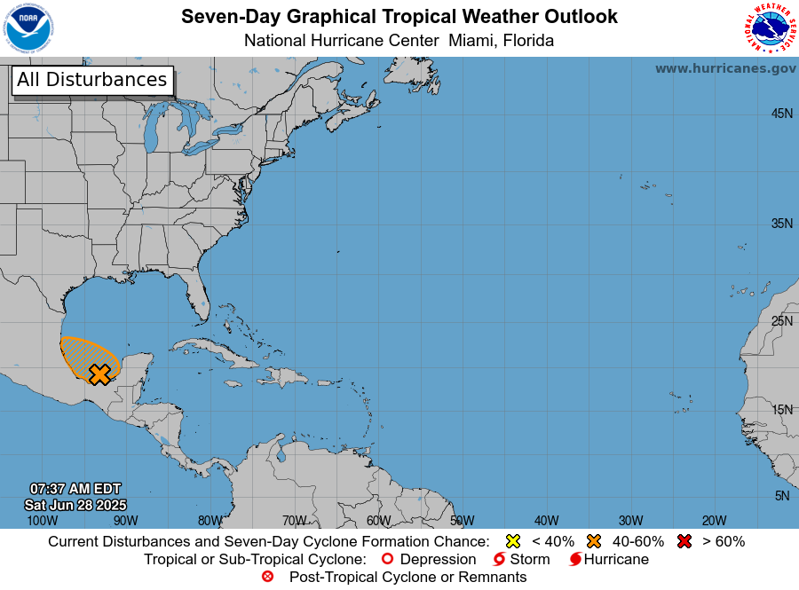
1. Bay of Campeche (AL91):
An area of low pressure located in the eastern Bay of Campeche near
the Mexican coastline continues to produce a broad region of
disorganized shower and thunderstorm activity over the Yucatan
Peninsula and adjacent waters. Additional development is possible
today and Sunday as the low moves generally west-northwestward, and
a tropical depression could form during this period while the system
remains over the waters of the Bay of Campeche. By Monday, this
system should move inland over eastern Mexico, ending its chances of
development. Regardless of tropical cyclone formation, locally heavy
rains are possible over portions of Belize, Guatemala, and
southeastern Mexico during the next few days. An Air Force Reserve
Hurricane Hunter aircraft is scheduled to investigate the system
later today, if necessary.
* Formation chance through 48 hours...medium...50 percent.
* Formation chance through 7 days...medium...50 percent.


Forecaster Papin


