ZCZC MIATWOAT ALL
TTAA00 KNHC DDHHMM
Tropical Weather Outlook
NWS National Hurricane Center Miami FL
800 AM EDT Tue Oct 17 2023
For the North Atlantic...Caribbean Sea and the Gulf of Mexico:
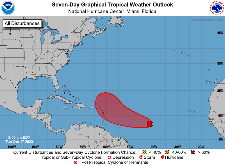
1. Central Tropical Atlantic (AL94):
A broad area of low pressure located over the central tropical
Atlantic about 1100 miles east of the Windward Islands continues to
produce a large area of disorganized showers and thunderstorms.
Environmental conditions are expected to remain conducive for
gradual development, and a tropical depression will likely form
during the next 2-3 days while the system moves westward to
west-northwestward across the central and western tropical Atlantic.
Interests in the Lesser Antilles should monitor the progress of
this system. Additional information on this system, including gale
warnings, can be found in High Seas Forecasts issued by the
National Weather Service.
* Formation chance through 48 hours...medium...60 percent.
* Formation chance through 7 days...high...80 percent.
High Seas Forecasts issued by the National Weather Service
can be found under AWIPS header NFDHSFAT1, WMO header FZNT01
KWBC, and online at ocean.weather.gov/shtml/NFDHSFAT1.php
Forecaster Blake