


NHC Graphical Outlook Archive
« Earliest Available ‹ Earlier Later › Latest Available »
Place your mouse cursor over areas of interest for more information
| GIS data: .shp |
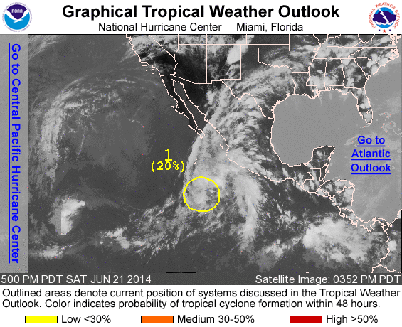
ZCZC MIATWOEP ALL
TTAA00 KNHC DDHHMM

TROPICAL WEATHER OUTLOOK
NWS NATIONAL HURRICANE CENTER MIAMI FL
500 PM PDT SAT JUN 21 2014

For the eastern North Pacific...east of 140 degrees west longitude:

1. Showers and thunderstorms remain disorganized in association with
a weak area of low pressure located about 550 miles southwest of
Manzanillo, Mexico. Upper-level winds are becoming increasingly
unfavorable for tropical cyclone formation, and any development of
this system is expected to be slow to occur while it moves northward
at around 10 mph.
* Formation chance through 48 hours...low...20 percent.
* Formation chance through 5 days...low...20 percent.

Forecaster Brennan
List of all Atlantic Outlooks
List of all East Pacific Outlooks