


NHC Graphical Outlook Archive
« Earliest Available ‹ Earlier Later › Latest Available »
Place your mouse cursor over areas of interest for more information
| GIS data: .shp |
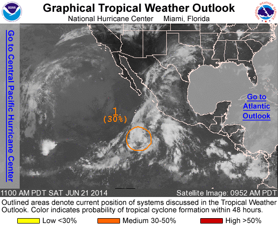
ZCZC MIATWOEP ALL
TTAA00 KNHC DDHHMM

TROPICAL WEATHER OUTLOOK
NWS NATIONAL HURRICANE CENTER MIAMI FL
1100 AM PDT SAT JUN 21 2014

For the eastern North Pacific...east of 140 degrees west longitude:

1. Disorganized showers and thunderstorms continue in association with
a weak area of low pressure located about 650 miles southwest of
Manzanillo, Mexico.  Although this system still has some potential
for development today or Sunday, upper-level winds are becoming
increasingly hostile for tropical cyclone formation while the
system moves northward at 5 to 10 mph.
* Formation chance through 48 hours...medium...30 percent.
* Formation chance through 5 days...medium...30 percent.

Forecaster Landsea
List of all Atlantic Outlooks
List of all East Pacific Outlooks