


NHC Graphical Outlook Archive
« Earliest Available ‹ Earlier Later › Latest Available »
Place your mouse cursor over areas of interest for more information
| GIS data: .shp |
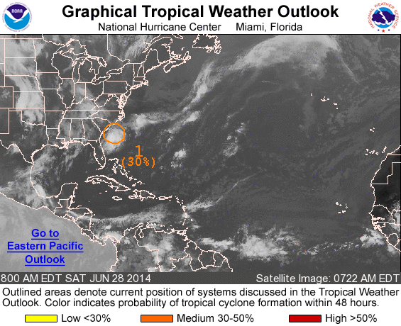
ZCZC MIATWOAT ALL
TTAA00 KNHC DDHHMM

TROPICAL WEATHER OUTLOOK
NWS NATIONAL HURRICANE CENTER MIAMI FL
800 AM EDT SAT JUN 28 2014

For the North Atlantic...Caribbean Sea and the Gulf of Mexico:

1. A weak low pressure system located just off the coast of South
Carolina is producing an area of disorganized showers and
thunderstorms. Environmental conditions are expected to remain
conducive for gradual development of this system while
it drifts southward during the next few days.
* Formation chance through 48 hours...medium...30 percent.
* Formation chance through 5 days...medium...50 percent.

Forecaster Brown
List of all Atlantic Outlooks
List of all East Pacific Outlooks