


NHC Graphical Outlook Archive
« Earliest Available ‹ Earlier Later › Latest Available »
Place your mouse cursor over areas of interest for more information
| GIS data: .shp |
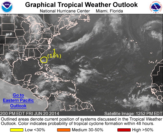
ZCZC MIATWOAT ALL
TTAA00 KNHC DDHHMM

TROPICAL WEATHER OUTLOOK
NWS NATIONAL HURRICANE CENTER MIAMI FL
200 PM EDT FRI JUN 20 2014

For the North Atlantic...Caribbean Sea and the Gulf of Mexico:

1. Shower and thunderstorm activity has diminished in association with
a weak area of low pressure located about 80 miles east-northeast
of Daytona Beach, Florida.  Environmental conditions are expected to
remain unfavorable for significant development while the system
drifts slowly northward this afternoon and tonight and begins to
accelerate northeastward on Saturday.
* Formation chance through 48 hours...low...10 percent.
* Formation chance through 5 days...low...10 percent.

Forecaster Brennan
List of all Atlantic Outlooks
List of all East Pacific Outlooks