


NHC Graphical Outlook Archive
« Earliest Available ‹ Earlier Later › Latest Available »
Place your mouse cursor over areas of interest for more information
| GIS data: .shp |
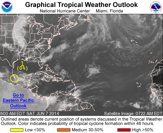
ZCZC MIATWOAT ALL
TTAA00 KNHC DDHHMM

TROPICAL WEATHER OUTLOOK
NWS NATIONAL HURRICANE CENTER MIAMI FL
800 AM EDT SAT JUN 7 2014

For the North Atlantic...Caribbean Sea and the Gulf of Mexico:

1. Surface observations and satellite imagery indicate that the low
pressure area previously near Veracruz, Mexico, has moved farther
inland and is dissipating.  However, the remnants of this system
could continue to produce gusty winds and heavy rains, along with
life-threatening flash floods and mud slides, over portions of
southeastern and eastern Mexico during the next day or two.
* Formation chance through 48 hours...low...near 0 percent.
* Formation chance through 5 days...low...near 0 percent.

Forecaster Beven
List of all Atlantic Outlooks
List of all East Pacific Outlooks