


TROPICAL DEPRESSION THREE
|
U.S. Watch/Warning Local Products Español: Aviso Publico Discusión |
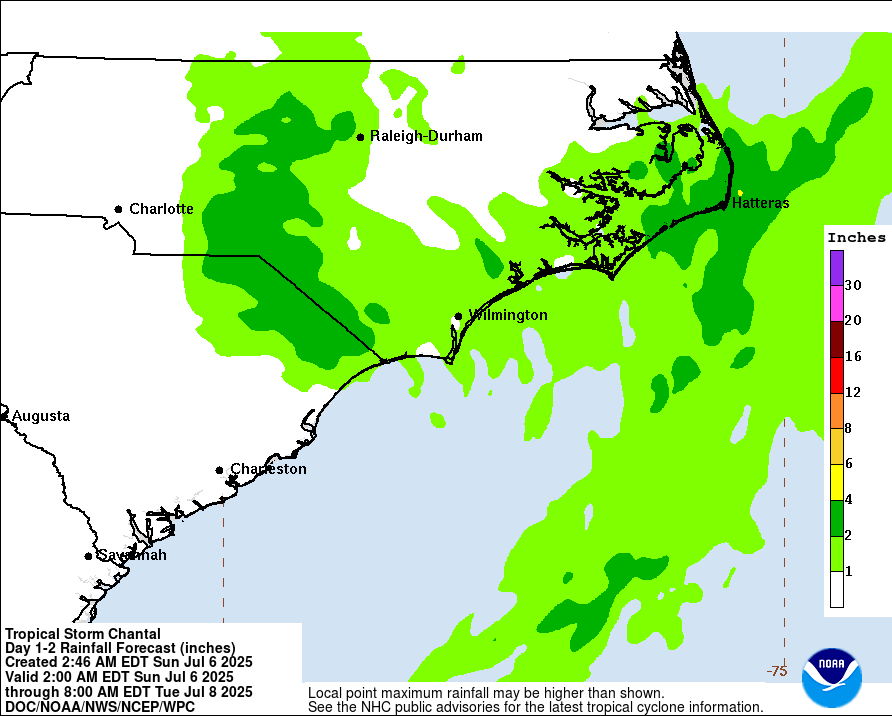
Rainfall Forecast (from the Weather Prediction Center)
![[Image of U.S. rainfall potential]](/storm_graphics/AT03/refresh/AL0325WPCQPF+gif/042034WPCQPF_sm.gif)
Click Here for a Printer Friendly Graphic
RAINFALL: Tropical Depression Three is expected to produce heavy rainfall across portions of the coastal plain of the Carolinas Saturday through Monday. Storm total rainfall of 2 to 4 inches, with local amounts to 6 inches, is expected. This would result in an elevated risk for flash flooding.
About this product:
This graphic is created by the NWS/NCEP Weather Prediction Center (WPC) and shows rainfall potential when a tropical cyclone threatens land. The graphic is displayed as a Quantitative Precipitation Forecast (QPF), which shows rainfall totals for a specified time period, based on forecaster discretion. For more rainfall information, visit the Specialized WPC Precipitation Forecasts. For WPC QPFs in KML Format, Click Here.