ZCZC MIATWOEP ALL
TTAA00 KNHC DDHHMM
Tropical Weather Outlook
NWS National Hurricane Center Miami FL
400 PM PST Sun Nov 15 2020
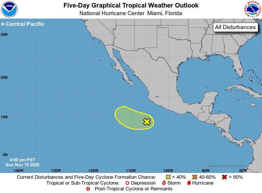
For the eastern North Pacific...east of 140 degrees west longitude:
1. Satellite imagery indicates that showers and thunderstorms remain
displaced well to the southeast of a broad area of low pressure
located several hundred miles southwest of the coast of southern
Mexico. Environmental conditions are expected to remain marginally
conducive for development over the next couple of days or so as the
system moves slowly west-northwestward or northwestward away from
the coast of Mexico. Thereafter, conditions are forecast to become
unfavorable for further development by the middle of this week.
* Formation chance through 48 hours...low...20 percent.
* Formation chance through 5 days...low...30 percent.
Forecaster Reinhart/Cangialosi