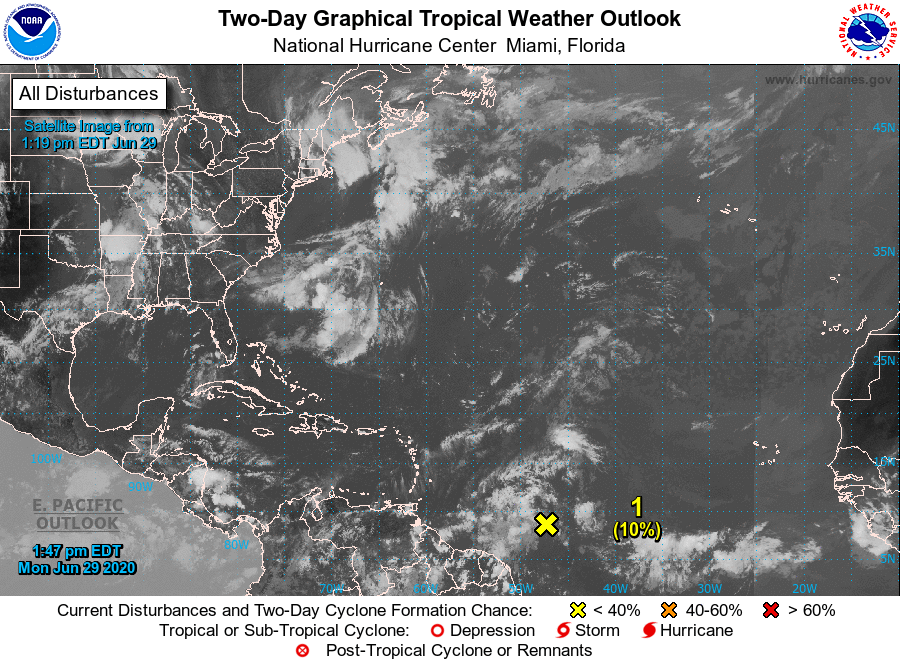
ZCZC MIATWOAT ALL
TTAA00 KNHC DDHHMM

Tropical Weather Outlook
NWS National Hurricane Center Miami FL
200 PM EDT Mon Jun 29 2020

For the North Atlantic...Caribbean Sea and the Gulf of Mexico:

1. Disorganized showers and thunderstorms located several hundred miles
east of the southern Windward Islands are associated with a
tropical wave.  Some slight development of this system is possible
during the next day or so while it moves westward to
west-northwestward at around 20 mph.  Strong upper-level winds are
forecast to inhibit further development by mid-week.
* Formation chance through 48 hours...low...10 percent.
* Formation chance through 5 days...low...10 percent.

2. An area of low pressure is forecast to form off of the southeastern
coast of the United States on Tuesday. Some development of this
system is possible later this week while it moves generally
northeastward well offshore of the east coast of the United States.
* Formation chance through 48 hours...low...near 0 percent.
* Formation chance through 5 days...low...20 percent.

Forecaster Pasch


