ZCZC MIATWOAT ALL
TTAA00 KNHC DDHHMM

Tropical Weather Outlook
NWS National Hurricane Center Miami FL
200 PM EDT Thu Oct 25 2018

For the North Atlantic...Caribbean Sea and the Gulf of Mexico:

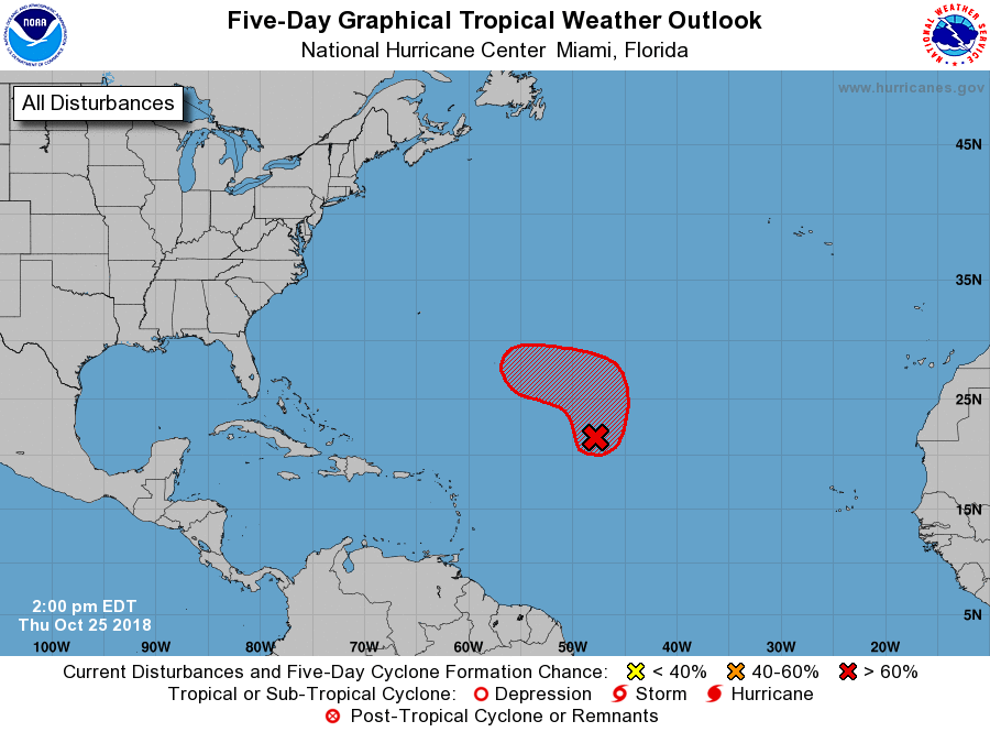
1. A low pressure system centered nearly 1000 miles east-northeast of
the northern Leeward Islands has changed little in organization
since this morning.  However, the low is expected to move generally
northward over the next couple of days into an area where
environmental conditions are forecast to be conducive for further
development, and a tropical or subtropical storm is likely to form
by early this weekend. After that time, the system is forecast to
turn westward well to the north or northeast of the Lesser Antilles
through early next week.
* Formation chance through 48 hours...high...80 percent.
* Formation chance through 5 days...high...90 percent.

Additional information on this system can be found in High Seas
Forecasts issued by the National Weather Service, under AWIPS
header NFDHSFAT1, WMO header FZNT01 KWBC, and available on the Web
at https://ocean.weather.gov/shtml/NFDHSFAT1.shtml

Forecaster Zelinsky


