ZCZC MIATWOEP ALL
TTAA00 KNHC DDHHMM
Tropical Weather Outlook
NWS National Hurricane Center Miami FL
1100 PM PDT Wed Jul 25 2018
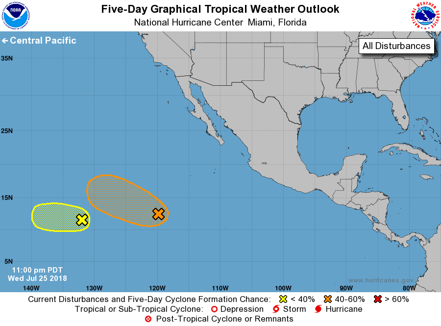
For the eastern North Pacific...east of 140 degrees west longitude:
1. An elongated area of low pressure located around 1000 miles
southwest of the southern tip of the Baja California peninsula is
producing a concentrated area of showers and thunderstorms.
Environmental conditions are expected to support gradual development
and a tropical depression could form during the next few days while
the system moves toward the west or west-northwest.
* Formation chance through 48 hours...medium...40 percent.
* Formation chance through 5 days...medium...60 percent.
2. Shower and thunderstorm activity has increased, but remains
disorganized, in association with a small low pressure system
located around 1700 miles west-southwest of the southern tip of the
Baja California peninsula. Some slight development is possible
overnight or tomorrow, but strong upper-level winds are likely to
prevent further development by Friday while the system moves
generally westward.
* Formation chance through 48 hours...low...30 percent.
* Formation chance through 5 days...low...30 percent.
Forecaster Zelinsky