ZCZC MIATWOEP ALL
TTAA00 KNHC DDHHMM
Tropical Weather Outlook
NWS National Hurricane Center Miami FL
1100 PM PDT Thu Jul 19 2018
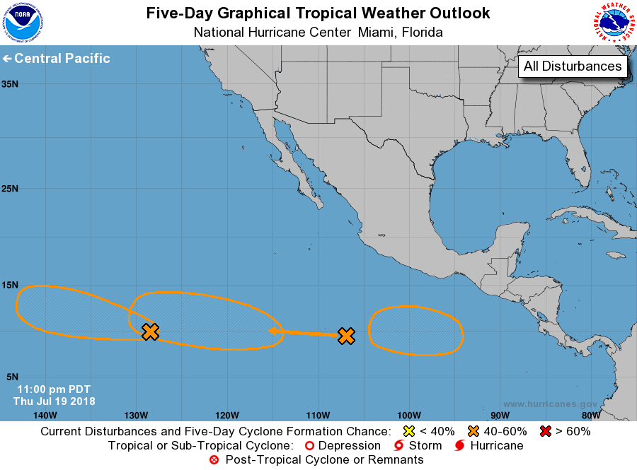
For the eastern North Pacific...east of 140 degrees west longitude:
1. An elongated area of low pressure located about 1450 miles southwest
of the southern tip of the Baja California peninsula is producing
cloudiness and showers while it moves westward at 15 to 20 mph.
Some slow development of this system is possible during the next few
days before upper-level winds become too strong for development by
early next week.
* Formation chance through 48 hours...low...20 percent.
* Formation chance through 5 days...medium...40 percent.
2. A large area of disorganized showers and thunderstorms centered
several hundred miles southwest of Acapulco, Mexico, is associated
with a tropical wave. Upper-level winds are forecast to become
increasingly favorable for development over the weekend, and a
tropical depression could form early next week while the system
moves westward at 10 to 15 mph.
* Formation chance through 48 hours...low...10 percent.
* Formation chance through 5 days...medium...60 percent.
3. An area of low pressure is likely to form early next week several
hundred miles south of the southern coast of Mexico. Environmental
conditions then appear to be conducive for gradual development of
this system while it moves westward or west-northwestward well south
of Mexico.
* Formation chance through 48 hours...low...near 0 percent.
* Formation chance through 5 days...medium...40 percent.
Forecaster Blake