ZCZC MIATWOEP ALL
TTAA00 KNHC DDHHMM
Tropical Weather Outlook
NWS National Hurricane Center Miami FL
500 PM PDT Sun Aug 7 2022
For the eastern North Pacific...east of 140 degrees west longitude:
Active Systems:
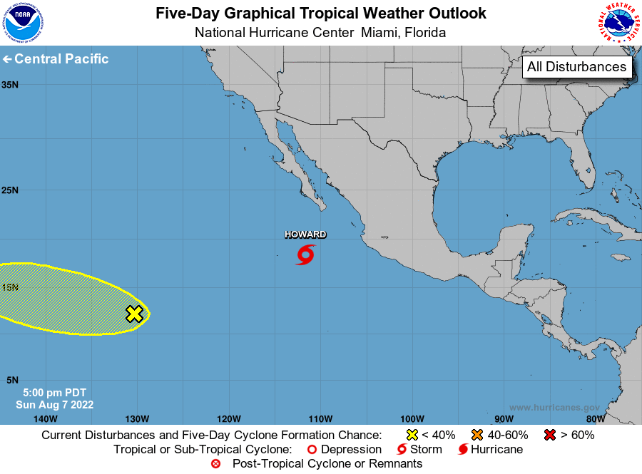
The National Hurricane Center is issuing advisories on recently
upgraded Tropical Storm Howard, located a few hundred miles south of
the southern tip of Baja California.
1. Well East-Southeast of the Hawaiian Islands:
A large area of disorganized showers and thunderstorms is
associated with a broad trough of low pressure located more than
1000 miles east-southeast of the Hawaiian Islands. Some gradual
development of this system is possible through the middle part of
this week while it moves generally westward into the central
Pacific basin.
* Formation chance through 48 hours...low...10 percent.
* Formation chance through 5 days...low...20 percent.
Forecaster Latto