ZCZC MIATWOEP ALL
TTAA00 KNHC DDHHMM
Tropical Weather Outlook
NWS National Hurricane Center Miami FL
1100 AM PDT Mon May 31 2021
For the eastern North Pacific...east of 140 degrees west longitude:
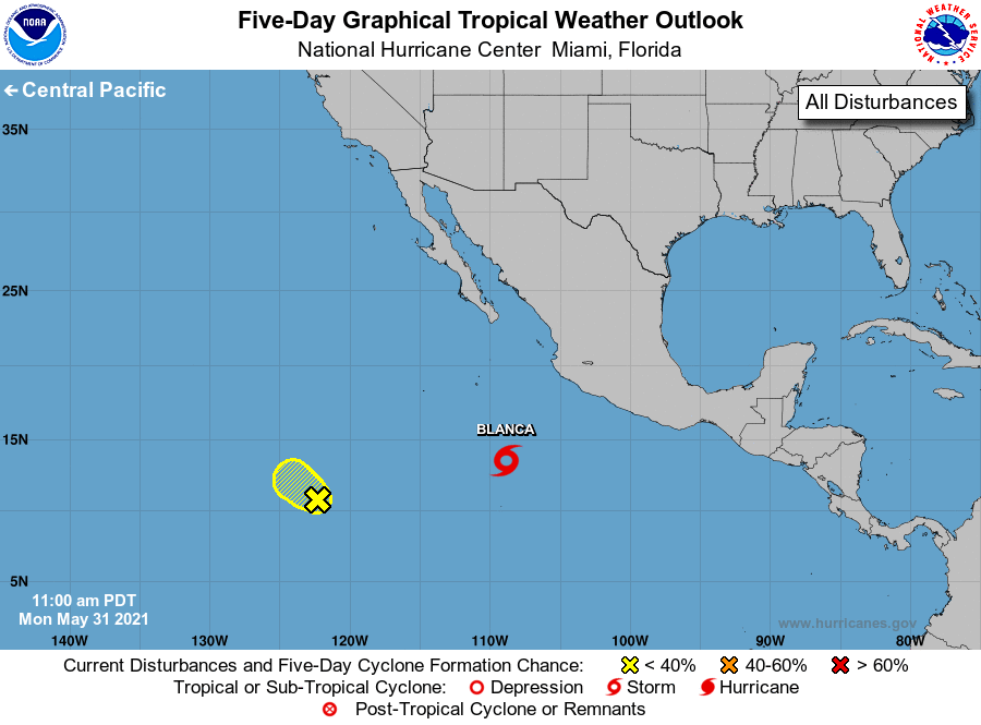
The National Hurricane Center is issuing advisories on Tropical
Depression Two-E, located about 500 miles south-southwest of
Manzanillo, Mexico.
1. A weak and broad area of low pressure located about 1200 miles
southwest of the southern tip of the Baja California peninsula
continues to produce disorganized shower and thunderstorm
activity. This system will be moving west-northwestward toward an
environment of unfavorable upper-level winds, drier air, and cooler
waters during the next day or so. Therefore, significant
development of this disturbance is not expected.
* Formation chance through 48 hours...low...10 percent.
* Formation chance through 5 days...low...10 percent.
Public Advisories on Tropical Depression Two-E are issued under WMO
header WTPZ32 KNHC and under AWIPS header MIATCPEP2.
Forecast/Advisories on Tropical Depression Two-E are issued under
WMO header WTPZ22 KNHC and under AWIPS header MIATCMEP2.
Forecaster Cangialosi