ZCZC MIATWOEP ALL
TTAA00 KNHC DDHHMM
Tropical Weather Outlook
NWS National Hurricane Center Miami FL
1100 AM PDT Wed Sep 26 2018
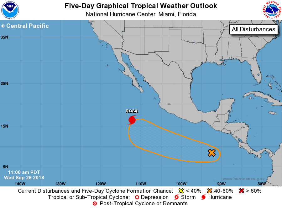
For the eastern North Pacific...east of 140 degrees west longitude:
The National Hurricane Center is issuing advisories on recently
upgraded Hurricane Rosa, located about 500 miles west-southwest of
Manzanillo, Mexico.
1. A broad area of low pressure is located a few hundred miles
south-southeast of the southern coast of Mexico. Environmental
conditions appear conducive for gradual development, and a tropical
cyclone could form early next week while it moves westward to
west-northwestward well offshore of the coast of Mexico.
* Formation chance through 48 hours...low...10 percent.
* Formation chance through 5 days...medium...40 percent.
Public Advisories on Hurricane Rosa are issued under WMO header
WTPZ35 KNHC and under AWIPS header MIATCPEP5.
Forecast/Advisories on Hurricane Rosa are issued under WMO
header WTPZ25 KNHC and under AWIPS header MIATCMEP5.
Forecaster Roberts