ZCZC MIATWOEP ALL
TTAA00 KNHC DDHHMM
Tropical Weather Outlook
NWS National Hurricane Center Miami FL
500 PM PDT Mon Aug 27 2018
For the eastern North Pacific...east of 140 degrees west longitude:
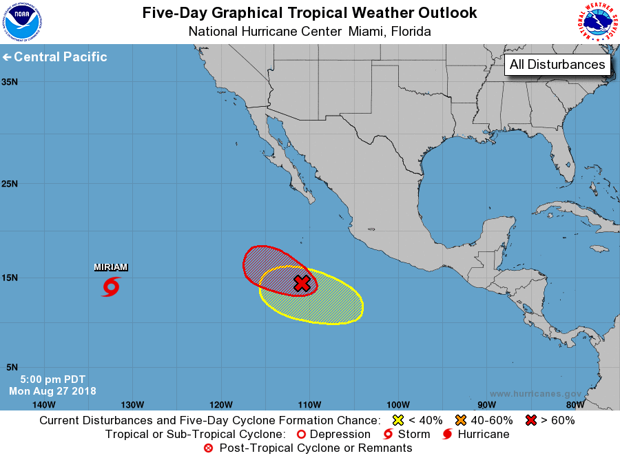
The National Hurricane Center is issuing advisories on Tropical
Storm Miriam, located about halfway between the western coast of
Mexico and Hawaii.
1. Showers and thunderstorms associated with an area of low pressure
located about 500 miles south of the southern tip of the Baja
California peninsula have changed little in organization over the
past several hours. However, environmental conditions are still
favorable for development and a tropical depression is expected to
form tonight or Tuesday while the system moves west-northwest to
northwest at 10 to 15 mph.
* Formation chance through 48 hours...high...90 percent.
* Formation chance through 5 days...high...90 percent.
2. Another area of low pressure is forecast to form well south or
southwest of the coast of southwestern Mexico in a few days. Some
gradual development of this system is possible by the end of the
week.
* Formation chance through 48 hours...low...near 0 percent.
* Formation chance through 5 days...low...20 percent.
Forecaster Zelinsky