ZCZC MIATWOEP ALL
TTAA00 KNHC DDHHMM
TROPICAL WEATHER OUTLOOK
NWS NATIONAL HURRICANE CENTER MIAMI FL
500 PM PDT TUE JUL 5 2016
For the eastern North Pacific...east of 140 degrees west longitude:
The National Hurricane Center is issuing advisories on Hurricane
Blas, located about 1000 miles southwest of the southern tip of
the Baja California peninsula.
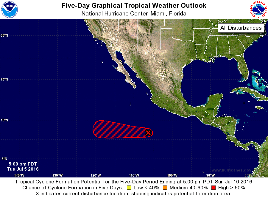
1. An area of low pressure located several hundred miles south-
southwest of Manzanillo, Mexico is producing a large area of
showers and thunderstorms. The circulation of the low has become
better defined today, and continued development is expected. This
system is likely to become a tropical depression during the next few
days while it moves westward.
* Formation chance through 48 hours...medium...40 percent
* Formation chance through 5 days...high...90 percent
Forecaster Cangialosi