


NHC Graphical Outlook Archive
|
« Earliest Available ‹ Earlier Later › Latest Available » |
| Eastern Pacific | Atlantic |
|
|
(mouse over weather symbols for details; click on weather symbols or disturbance numbers to switch views) |
Tropical Weather Outlook Text
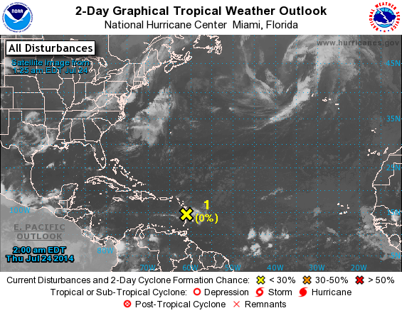
TROPICAL WEATHER OUTLOOK
NWS NATIONAL HURRICANE CENTER MIAMI FL
200 AM EDT THU JUL 24 2014

For the North Atlantic...Caribbean Sea and the Gulf of Mexico:

1. Disorganized showers and thunderstorms moving westward over
portions of the Lesser Antilles are associated with the remnants
of Tropical Depression Two.  There are no signs of a surface
circulation, and environmental conditions are not conducive for
re-development of this system as it moves west-northwestward at
about 25 mph.  Showers and gusty winds are possible through much of
the day, especially on the islands of Guadeloupe, Dominica,
Martinique, and St. Lucia.
* Formation chance through 48 hours...low...near 0 percent.
* Formation chance through 5 days...low...near 0 percent.

Forecaster Berg
List of Atlantic Outlooks (May 2023 - present)
List of East Pacific Outlooks (May 2023 - present)
List of Central Pacific Outlooks (May 2023 - present)
List of Atlantic Outlooks (July 2014 - April 2023)
List of East Pacific Outlooks (July 2014 - April 2023)
List of Central Pacific Outlooks (June 2019 - April 2023)
List of Atlantic Outlooks (June 2009 - June 2014)
List of East Pacific Outlooks (June 2009 - June 2014)