ZCZC HFOTWOCP ALL
TTAA00 PHFO DDHHMM
Tropical Weather Outlook
NWS Central Pacific Hurricane Center Honolulu HI
800 AM HST Mon Aug 28 2023
For the central North Pacific...between 140W and 180W:
Active Systems:
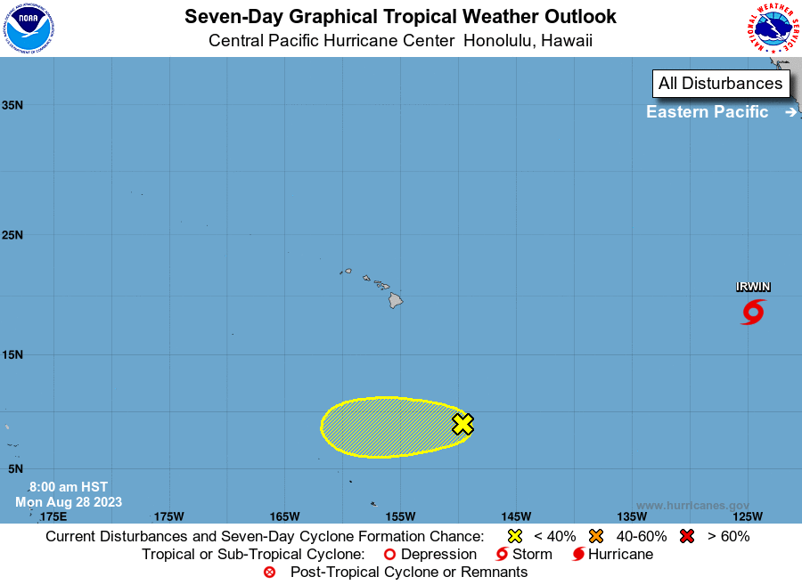
The National Hurricane Center in Miami, Florida is issuing
advisories on Tropical Storm Irwin, centered about 1000 miles west
southwest of the southern tip of the Baja California Sur peninsula
or 2000 miles east of Hilo, Hawaii. Irwin is forecast to move into
the Central Pacific Hurricane Center area of responsibility as a
post-tropical remnant low late Thursday or early Friday.
1. Approximately 900 miles southeast of Hilo, Hawaii:
An area of low pressure is producing disorganized showers and
thunderstorms. Environmental conditions are marginally conducive for
some slow development of this system over the next few days before
conditions become less conducive as it continues westward at 10 to
15 mph.
* Formation chance through 48 hours...low...20 percent.
* Formation chance through 7 days...low...20 percent.
Elsewhere, no tropical cyclones are expected during the next 7 days.
Public Advisories on Tropical Storm Irwin are issued under WMO
header WTPZ35 KNHC and under AWIPS header MIATCPEP5.
Forecast/Advisories on Tropical Storm Irwin are issued under
WMO header WTPZ25 KNHC and under AWIPS header MIATCMEP5.
Forecaster Blood