ZCZC MIATWOAT ALL
TTAA00 KNHC DDHHMM
Tropical Weather Outlook
NWS National Hurricane Center Miami FL
800 AM EDT Tue Aug 1 2023
For the North Atlantic...Caribbean Sea and the Gulf of Mexico:
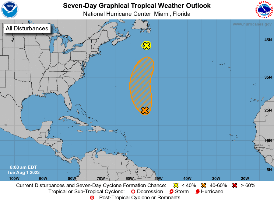
1. Central Tropical Atlantic (AL96):
Showers and thunderstorms remain disorganized in association with a
low pressure area located about 750 miles northeast of the northern
Leeward Islands. Environmental conditions still could support
tropical cyclone formation during the next two to three days while
the system moves northwestward and then northward at 10 to 15 mph
over the central subtropical Atlantic.
* Formation chance through 48 hours...medium...40 percent.
* Formation chance through 7 days...medium...50 percent.
2. Western Atlantic (AL97):
Satellite imagery shows that the gale-force non-tropical low
pressure system located over the western Atlantic several hundred
miles south of Cape Race Newfoundland has merged with a frontal
system. Therefore, tropical cyclone formation is not anticipated.
Additional information on the low, including gale warnings, can be
found in High Seas Forecasts issued by the National Weather Service.
* Formation chance through 48 hours...low...near 0 percent.
* Formation chance through 7 days...low...near 0 percent.
For more information about marine hazards associated with AL97,
please see High Seas Forecasts issued by the National Weather
Service found under AWIPS header NFDHSFAT1, WMO header
FZNT01 KWBC, and online at
ocean.weather.gov/shtml/NFDHSFAT1.php
Forecaster Beven