ZCZC MIATWOAT ALL
TTAA00 KNHC DDHHMM

Tropical Weather Outlook
NWS National Hurricane Center Miami FL
200 AM EDT Fri Jun 30 2023

For the North Atlantic...Caribbean Sea and the Gulf of Mexico:

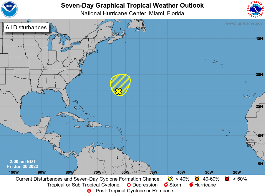
1. Western Atlantic Ocean:
A surface trough continues to produce disorganized showers and
thunderstorms a couple of hundred miles to the south-southeast of
Bermuda.  This system is expected to develop into a broad area of
low pressure during the next couple of days at it moves
northeastward.  However, upper-level winds do not appear conducive
for additional development into a tropical or subtropical cyclone.
* Formation chance through 48 hours...low...10 percent.
* Formation chance through 7 days...low...10 percent.

Forecaster Beven



 NHC on Facebook
 X
X YouTube
 NHC Blog: