ZCZC MIATWOEP ALL
TTAA00 KNHC DDHHMM
Tropical Weather Outlook
NWS National Hurricane Center Miami FL
1100 AM PDT Sat Jun 28 2025
For the eastern and central North Pacific east of 180 longitude:
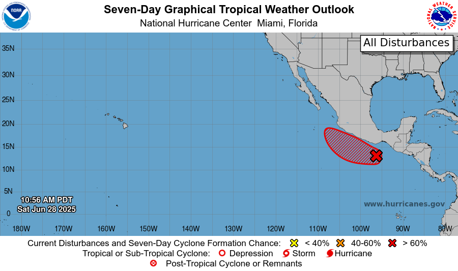
1. Offshore of Southern Mexico (EP95):
Showers and thunderstorms associated with a broad area of low
pressure located a few hundred miles south-southwest of the Gulf of
Tehuantepec continue to show signs of organization. Environmental
conditions appear conducive for development, and a tropical
depression is expected to form during the next day or so while the
system moves slowly west-northwestward off the coast of southern
Mexico. Potential Tropical Cyclone advisories could be initiated
later today. For additional information, including gale warnings,
please see High Seas Forecasts issued by the National Weather
Service. Regardless of development, locally heavy rainfall is
expected over portions of Central America and southeastern Mexico
through the weekend.
* Formation chance through 48 hours...high...80 percent.
* Formation chance through 7 days...high...90 percent.
High Seas Forecasts issued by the National Weather Service
can be found under AWIPS header NFDHSFEPI, WMO header FZPN02
KWBC, and on the web at ocean.weather.gov/shtml/NFDHSFEPI.php
Forecaster Pasch