ZCZC MIATWOEP ALL
TTAA00 KNHC DDHHMM
Tropical Weather Outlook
NWS National Hurricane Center Miami FL
1100 PM PDT Tue May 27 2025
For the eastern North Pacific...east of 140 degrees west longitude:
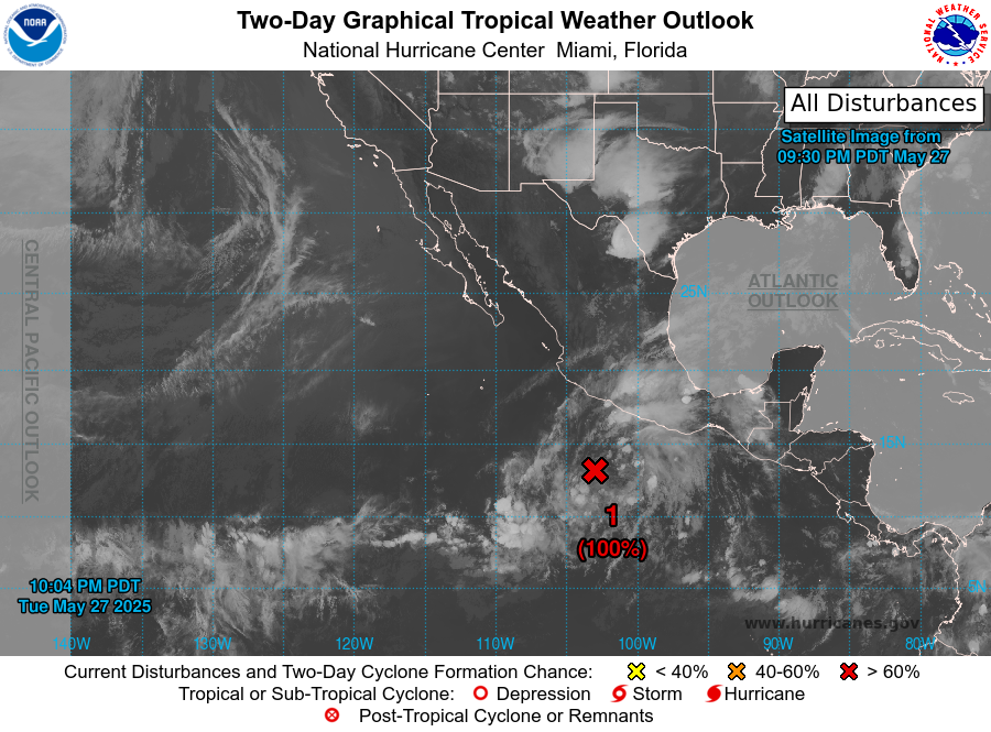
1. South of the Southern Coast of Mexico (EP90):
Showers and thunderstorms continue to show signs of organization
near a broad area of low pressure located several hundred miles
south of the coast of southern Mexico, but the system still lacks a
well-defined circulation. Environmental conditions remain favorable
for further development, and a tropical depression or tropical storm
is expected to form on Wednesday as the low moves generally
west-northwestward at around 10 mph.
* Formation chance through 48 hours...high...near 100 percent.
* Formation chance through 7 days...high...near 100 percent.
Forecaster Reinhart