ZCZC MIATWOEP ALL
TTAA00 KNHC DDHHMM
Tropical Weather Outlook
NWS National Hurricane Center Miami FL
500 PM PDT Mon May 26 2025
For the eastern North Pacific...east of 140 degrees west longitude:
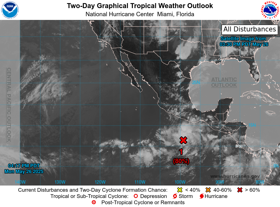
1. South of the Southern Coast of Mexico (EP90):
Showers and thunderstorms are gradually becoming better organized
and more concentrated near a broad area of low pressure located
several hundred miles south of the coast of southern Mexico.
Environmental conditions are favorable for further development of
this system, and a tropical depression is expected to form by the
middle portion of the week while the low moves generally
west-northwestward at around 10 mph.
* Formation chance through 48 hours...high...80 percent.
* Formation chance through 7 days...high...90 percent.
Forecaster Papin