Skip Navigation Links
NOAA NOAA United States Department of Commerce

NHC Graphical Outlook Archive


« Earliest Available         ‹ Earlier         Later ›         Latest Available »
GIS Shapefiles
Central Pacific Eastern Pacific Atlantic

View 2-Day Graphical Tropical Weather Outlook
Click for Atlantic Click for Atlantic

Tropical Weather Outlook Text

ZCZC MIATWOEP ALL
TTAA00 KNHC DDHHMM

Tropical Weather Outlook
NWS National Hurricane Center Miami FL
1000 AM PST Fri Nov 15 2024

For the eastern North Pacific...east of 140 degrees west longitude:

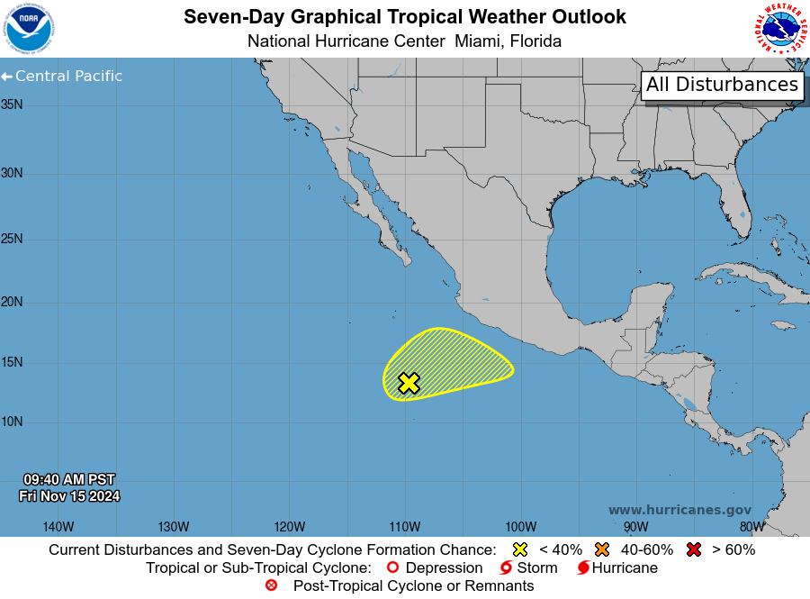
1. Central East Pacific:
An area of low pressure currently located several hundred
miles southwest of the coast of southwestern Mexico is producing
disorganized shower and thunderstorm activity. Environmental
conditions appear marginally favorable for some slow development of
this system as it moves slowly east-northeastward towards the
southwestern coast of Mexico.
* Formation chance through 48 hours...low...10 percent.
* Formation chance through 7 days...low...10 percent.

Forecaster Papin


List of Atlantic Outlooks (May 2023 - Present)
List of East Pacific Outlooks (May 2023 - Present)
List of Central Pacific Outlooks (May 2023 - Present)
List of Atlantic Outlooks (July 2014 - April 2023)
List of East Pacific Outlooks (July 2014 - April 2023)
List of Central Pacific Outlooks (June 2019 - April 2023)
List of Atlantic Outlooks (June 2009 - June 2014)
List of East Pacific Outlooks (June 2009 - June 2014)