Skip Navigation Links
NOAA NOAA United States Department of Commerce

NHC Graphical Outlook Archive


« Earliest Available         ‹ Earlier         Later ›         Latest Available »
GIS Shapefiles
Central Pacific Eastern Pacific Atlantic

View 7-Day Graphical Tropical Weather Outlook
Click for Atlantic

Tropical Weather Outlook Text

ZCZC MIATWOEP ALL
TTAA00 KNHC DDHHMM

Tropical Weather Outlook
NWS National Hurricane Center Miami FL
500 PM PDT Sun Oct 20 2024

For the eastern North Pacific...east of 140 degrees west longitude:

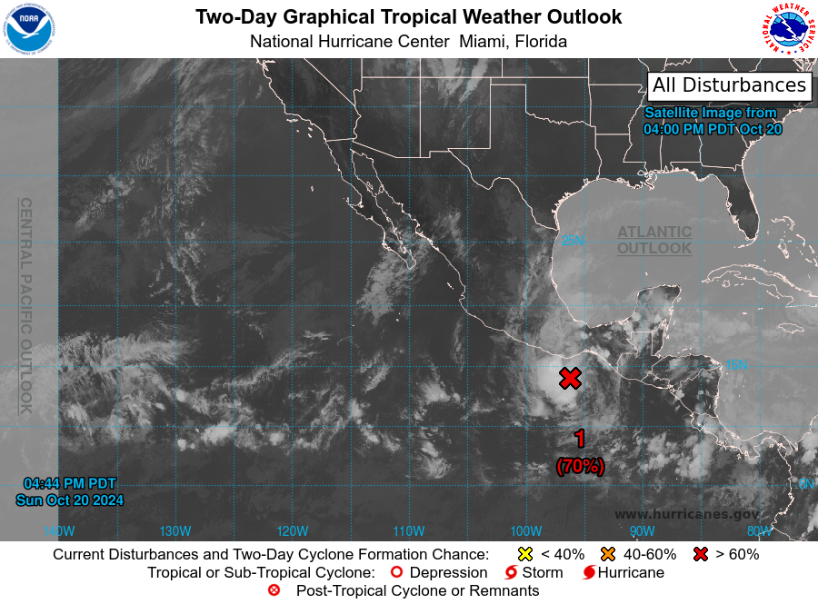
1. South of Southwestern Mexico:
A trough of low pressure over the Gulf of Tehuantepec is producing
disorganized showers and thunderstorms. Environmental conditions are
conducive for further development, and a tropical depression is
likely to form within the next couple of days, while the system
moves westward at around 15 mph away from the coast of Mexico.
* Formation chance through 48 hours...high...70 percent.
* Formation chance through 7 days...high...90 percent.

Forecaster Bucci


List of Atlantic Outlooks (May 2023 - Present)
List of East Pacific Outlooks (May 2023 - Present)
List of Central Pacific Outlooks (May 2023 - Present)
List of Atlantic Outlooks (July 2014 - April 2023)
List of East Pacific Outlooks (July 2014 - April 2023)
List of Central Pacific Outlooks (June 2019 - April 2023)
List of Atlantic Outlooks (June 2009 - June 2014)
List of East Pacific Outlooks (June 2009 - June 2014)