Skip Navigation Links
NOAA NOAA United States Department of Commerce

NHC Graphical Outlook Archive


« Earliest Available         ‹ Earlier         Later ›         Latest Available »
GIS Shapefiles
Central Pacific Eastern Pacific Atlantic

View 2-Day Graphical Tropical Weather Outlook
Click for Atlantic Click for Atlantic

Tropical Weather Outlook Text

ZCZC MIATWOEP ALL
TTAA00 KNHC DDHHMM

Tropical Weather Outlook
NWS National Hurricane Center Miami FL
1100 AM PDT Wed Oct 9 2024

For the eastern North Pacific...east of 140 degrees west longitude:

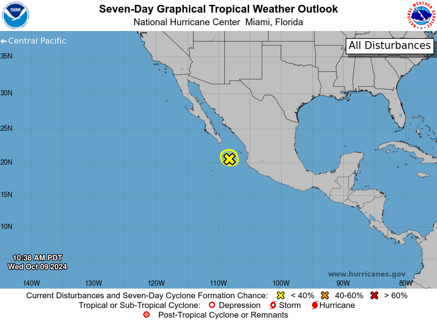
1. Offshore of Southwestern Mexico (EP99):
Showers and thunderstorms have become less organized in association
with an elongated area of low pressure located a couple hundred
miles southeast of the southern tip of the Baja California
peninsula. By tonight, increasing upper-level winds and dry air
should end the chances for any further development as the
disturbance drifts toward the northwest or north-northwest.
* Formation chance through 48 hours...low...10 percent.
* Formation chance through 7 days...low...10 percent.

Forecaster Hagen


List of Atlantic Outlooks (May 2023 - Present)
List of East Pacific Outlooks (May 2023 - Present)
List of Central Pacific Outlooks (May 2023 - Present)
List of Atlantic Outlooks (July 2014 - April 2023)
List of East Pacific Outlooks (July 2014 - April 2023)
List of Central Pacific Outlooks (June 2019 - April 2023)
List of Atlantic Outlooks (June 2009 - June 2014)
List of East Pacific Outlooks (June 2009 - June 2014)