ZCZC MIATWOEP ALL
TTAA00 KNHC DDHHMM
Tropical Weather Outlook
NWS National Hurricane Center Miami FL
500 PM PDT Sun Sep 22 2024
For the eastern North Pacific...east of 140 degrees west longitude:
Active Systems:
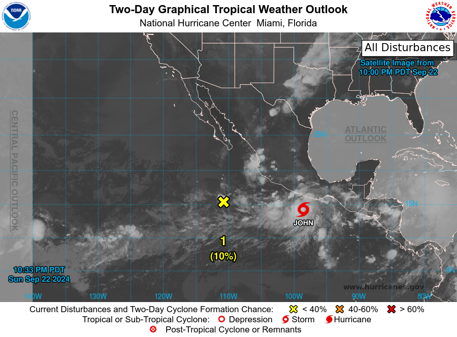
The National Hurricane Center is issuing advisories on newly formed
Tropical Depression Ten-E, located south of southern Mexico.
1. Central Portion of the East Pacific:
A trough of low pressure located several hundred miles
west-southwest of southwestern Mexico is producing disorganized
showers and thunderstorms. Environmental conditions appear
conducive for some slow development of this system, and a tropical
depression could form during the middle part of the week while the
system moves slowly eastward or northeastward.
* Formation chance through 48 hours...low...10 percent.
* Formation chance through 7 days...medium...40 percent.
Public Advisories on Tropical Depression Ten-E are issued under WMO
header WTPZ35 KNHC and under AWIPS header MIATCPEP5.
Forecast/Advisories on Tropical Depression Ten-E are issued under
WMO header WTPZ25 KNHC and under AWIPS header MIATCMEP5.
Forecaster Kelly