ZCZC MIATWOEP ALL
TTAA00 KNHC DDHHMM
Tropical Weather Outlook
NWS National Hurricane Center Miami FL
Issued by the NWS Weather Prediction Center College Park MD
1100 AM PDT Thu Aug 8 2024
For the eastern North Pacific...east of 140 degrees west longitude:
Active Systems:
The National Hurricane Center is issuing advisories on Tropical
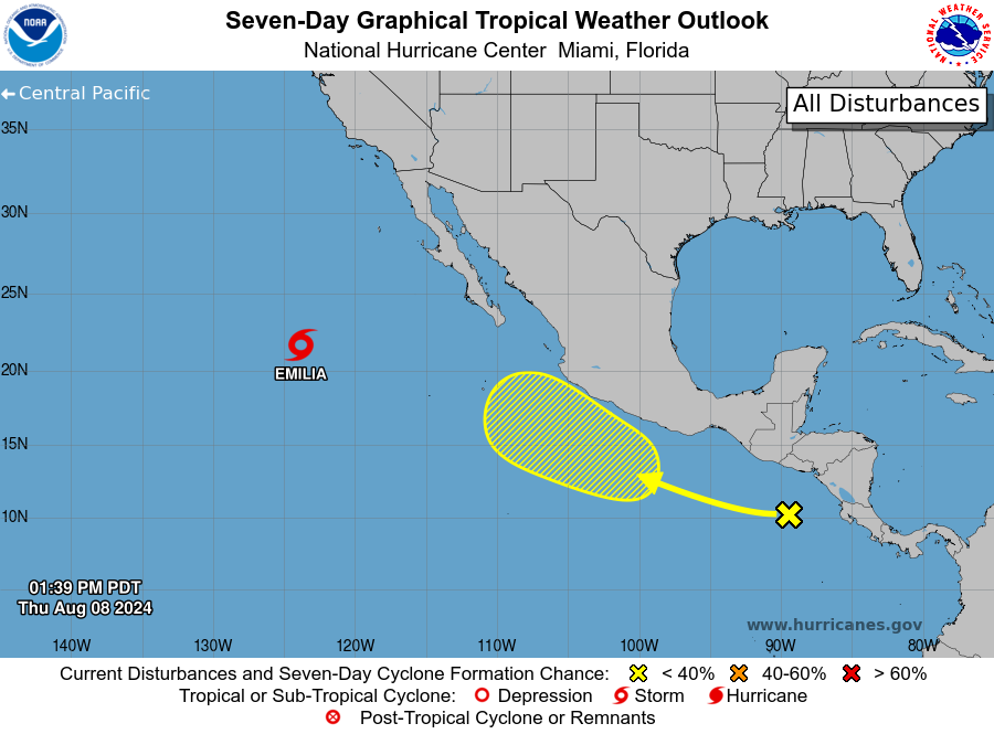
Storm Emilia, located several hundred miles west of the southern tip
of the Baja California peninsula.
1. South of Southern Mexico:
A tropical wave located over the far eastern portion of the eastern
Pacific is producing limited and disorganized showers and
thunderstorms. Gradual development of this system will be possible
during the next next several days while it moves west-northwestward
at around 15 mph, parallel to the coast of southwestern Mexico.
* Formation chance through 48 hours...low...10 percent.
* Formation chance through 7 days...low...30 percent.
Forecaster D. Zelinsky