ZCZC MIATWOEP ALL
TTAA00 KNHC DDHHMM
Tropical Weather Outlook
NWS National Hurricane Center Miami FL
1100 PM PDT Mon Jul 15 2024
For the eastern North Pacific...east of 140 degrees west longitude:
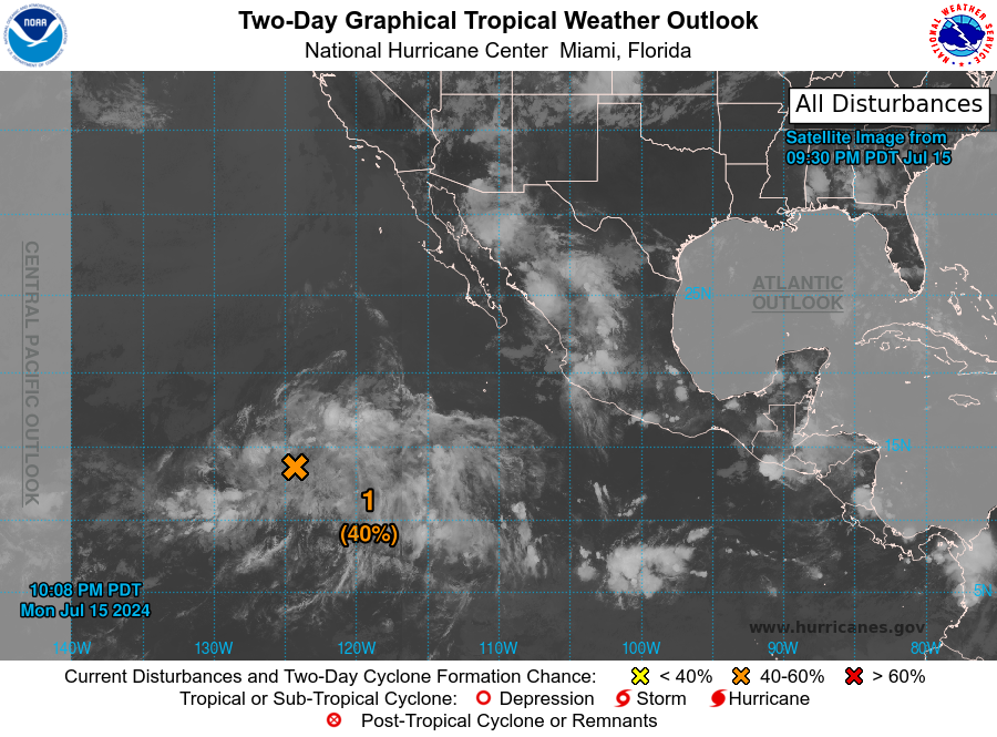
1. Western East Pacific (EP92):
A broad area of low pressure located several hundred miles
southwest of the southern tip of the Baja California peninsula
continues to produce a large area of disorganized showers and
thunderstorms. Environmental conditions appear generally conducive
for further development, and a tropical depression could form
around midweek while the system moves west-northwestward at 10 to
15 mph across the western part of the basin.
* Formation chance through 48 hours...medium...40 percent.
* Formation chance through 7 days...medium...40 percent.
Forecaster Blake