Skip Navigation Links
NOAA NOAA United States Department of Commerce

NHC Graphical Outlook Archive


« Earliest Available         ‹ Earlier         Later ›         Latest Available »
GIS Shapefiles
Central Pacific Eastern Pacific Atlantic

View 2-Day Graphical Tropical Weather Outlook with Satellite
Click for Eastern Pacific

Tropical Weather Outlook Text

ZCZC MIATWOAT ALL
TTAA00 KNHC DDHHMM

Tropical Weather Outlook
NWS National Hurricane Center Miami FL
800 PM EDT Thu Jun 26 2025

For the North Atlantic...Caribbean Sea and the Gulf of America:
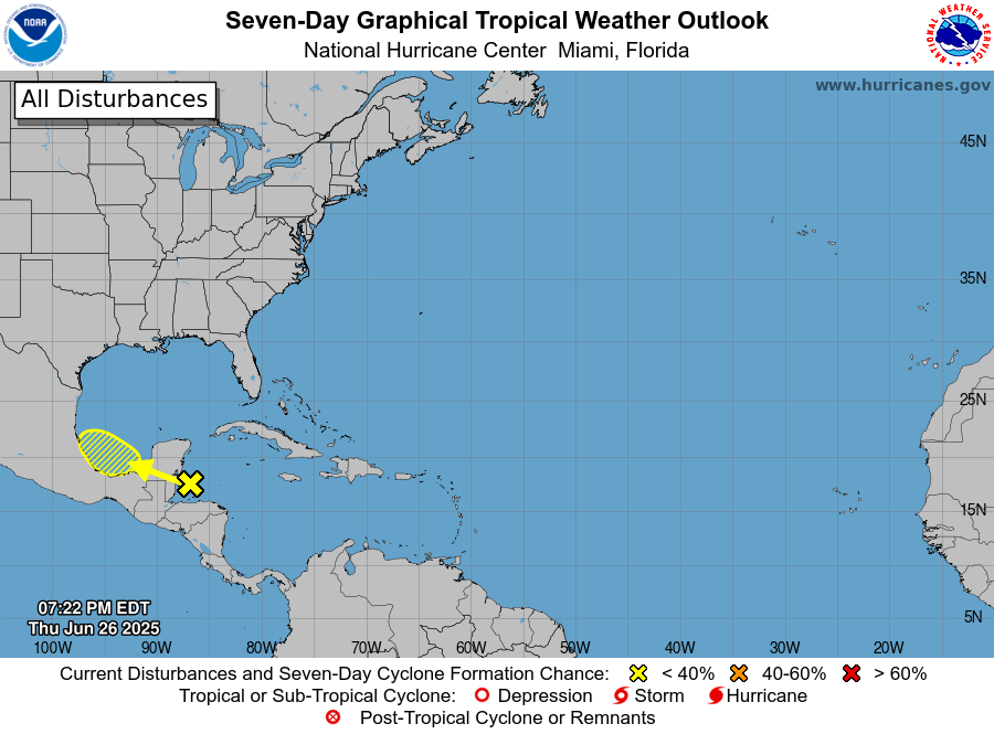
1. Bay of Campeche:
An area of showers and thunderstorms currently over the northwestern
Caribbean sea and adjacent land areas is expected to move
west-northwestward into the Bay of Campeche Saturday or Saturday
night. A low pressure area could form after that time if the system
remains over water.
* Formation chance through 48 hours...low...10 percent.
* Formation chance through 7 days...low...20 percent.


Forecaster Beven


List of Atlantic Outlooks (May 2023 - Present)
List of East Pacific Outlooks (May 2023 - Present)
List of Central Pacific Outlooks (May 2023 - Present)
List of Atlantic Outlooks (July 2014 - April 2023)
List of East Pacific Outlooks (July 2014 - April 2023)
List of Central Pacific Outlooks (June 2019 - April 2023)
List of Atlantic Outlooks (June 2009 - June 2014)
List of East Pacific Outlooks (June 2009 - June 2014)