ZCZC MIATWOAT ALL
TTAA00 KNHC DDHHMM

Special Tropical Weather Outlook
NWS National Hurricane Center Miami FL
830 AM EDT Tue Jun 24 2025

For the North Atlantic...Caribbean Sea and the Gulf of America:

Special outlook issued to update AL90 formation chances

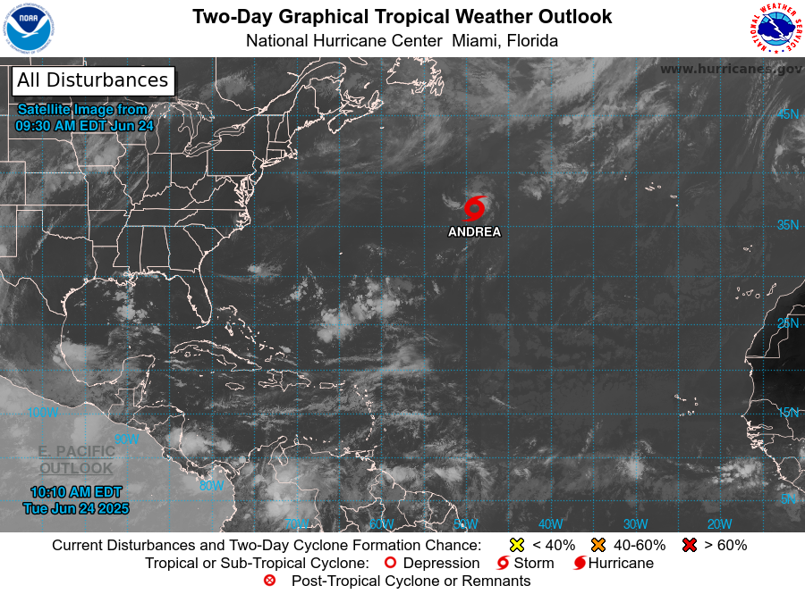
1. Central Subtropical Atlantic (AL90):
Satellite images indicate that shower and thunderstorm activity
has become better organized in association with a small gale-force
low-pressure system located about 900 miles east-northeast of
Bermuda.  This system will likely become a short-lived tropical
storm later today before more hostile environmental conditions end
its opportunity for development by this evening.  The low is
forecast to move northeastward at around 15 to 20 mph while
remaining over the open central Atlantic.  For additional
information, including gale warnings, please see High Seas
Forecasts issued by the National Weather Service.
* Formation chance through 48 hours...high...70 percent.
* Formation chance through 7 days...high...70 percent.


High Seas Forecasts issued by the National Weather Service
can be found under AWIPS header NFDHSFAT1, WMO header FZNT01
KWBC, and online at ocean.weather.gov/shtml/NFDHSFAT1.php


Forecaster Blake


