ZCZC MIATWOAT ALL
TTAA00 KNHC DDHHMM
Tropical Weather Outlook
NWS National Hurricane Center Miami FL
800 PM EDT Sun Jun 22 2025
For the North Atlantic...Caribbean Sea and the Gulf of America:
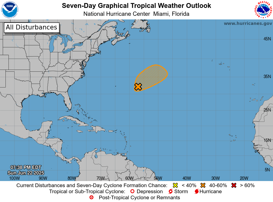
1. Central Subtropical Atlantic (AL90):
Showers and thunderstorms are showing some signs of organization in
association with an area of the low pressure located about 450 miles
east of Bermuda. Earlier satellite-derived wind data indicated the
system possessed a well-defined surface circulation, and additional
organization of the shower and thunderstorm activity could lead to
the formation of a short-lived tropical depression over the next day
or so. By Tuesday, this system is expected to encounter less
favorable environmental conditions, ending its opportunity for
further development. Regardless of development, the system is
forecast to move northeastward at 5 to 10 mph, remaining over the
open central Atlantic.
* Formation chance through 48 hours...medium...40 percent.
* Formation chance through 7 days...medium...40 percent.
Forecaster Papin