ZCZC MIATWOAT ALL
TTAA00 KNHC DDHHMM
Tropical Weather Outlook
NWS National Hurricane Center Miami FL
200 AM EDT Wed Jun 4 2025
For the North Atlantic...Caribbean Sea and the Gulf of America:
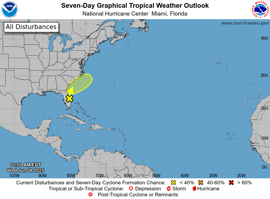
1. Offshore of the Southeastern U.S. Coast:
Showers and thunderstorms located over the Florida peninsula,
southeastern Georgia, the northwestern Bahamas, and the adjacent
Atlantic and Gulf waters are associated with a broad trough of low
pressure. A non-tropical low pressure area is forecast to form from
this system near the southeastern U.S. coast during the next couple
of days. If the low spends time offshore, it could gradually develop
some subtropical or tropical characteristics late this week while
moving northeastward at 10 to 15 mph. Regardless of development,
periods of heavy rainfall are possible for coastal portions of the
Carolinas through Friday.
* Formation chance through 48 hours...low...10 percent.
* Formation chance through 7 days...low...10 percent.
Forecaster Hagen