ZCZC MIATWOAT ALL
TTAA00 KNHC DDHHMM

Tropical Weather Outlook
NWS National Hurricane Center Miami FL
800 PM EDT Thu Sep 26 2024

For the North Atlantic...Caribbean Sea and the Gulf of Mexico:

Active Systems:
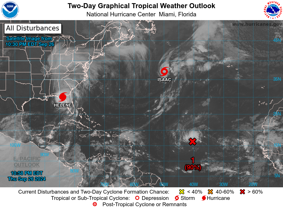
The National Hurricane Center is issuing advisories on Hurricane
Helene, located over the northeastern Gulf of Mexico and on
Tropical Storm Isaac, located over the central Subtropical Atlantic
Ocean.

1. Eastern and Central Tropical Atlantic (AL98):
Showers and thunderstorms associated with an area of low pressure
located about one thousand miles west of the Cabo Verde Islands
continue to show signs of organization. Recent satellite imagery
suggests the system does not yet have a well-defined surface
circulation. However, environmental conditions are expected to be
conducive for further development. A tropical depression is
expected to form tonight or on Friday while the disturbance moves
generally westward to west-northwestward at 10 to 15 mph. The
system is then forecast to slow down and turn north-northwestward
late Friday and Saturday.
* Formation chance through 48 hours...high...90 percent.
* Formation chance through 7 days...high...90 percent.

2. Western Caribbean:
An area of low pressure could form over the western Caribbean Sea
by the middle of next week. Environmental conditions are expected to
be conducive for slow development thereafter, while the system
moves generally northwestward.
* Formation chance through 48 hours...low...near 0 percent.
* Formation chance through 7 days...low...20 percent.


Public Advisories on Tropical Storm Isaac are issued under WMO
header WTNT35 KNHC and under AWIPS header MIATCPAT5.
Forecast/Advisories on Tropical Storm Isaac are issued under WMO
header WTNT25 KNHC and under AWIPS header MIATCMAT5.

Forecaster Hagen


